
Florida Waterways
“The Ocklawaha River”
By Kevin McCarthy
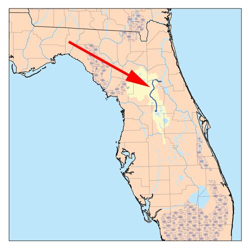
One of the most beautiful, but beleaguered rivers in North Central Florida, is the Ocklawaha, a 100-mile-long waterway that is the largest tributary of the St. Johns River. It was once, in the 1960s, supposed to be part of the ill-conceived Cross Florida Barge Canal, but was spared destruction when the canal project was discontinued in 1971.
The Rodman Dam, near the St. Johns, blocks the natural flow of the Ocklawaha and forms the Rodman Reservoir/Lake Ocklawaha, but environmentalists have been fighting for years to dismantle the dam and restore the river’s natural flow.
The name of the Ocklawaha goes back to a Creek Indian word meaning “muddy,” an appropriate name, since the river is not as crystal clear as some waterways in the state. The river suffers occasionally from pollution caused by discharges from incoming streams and man-made canals, as well as from the polluted Lake Apopka near Orlando.
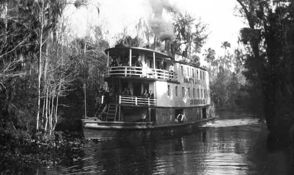
Visitors from Jacksonville and Palatka used to go by narrow steamboat up the Ocklawaha to Silver Springs, but hydrilla and submerged logs make such trips a thing of the past. Such personages as Thomas Edison, Ulysses S. Grant, Mary Todd Lincoln, and Harriet Beecher Stowe made the trip, but the coming of the railroad in the 1880s, and the difficulties of maintaining the river, led to the demise of those trips. A painting by famed artist Christopher Still, entitled “The Okeehumkee on the Oklawaha” – with a variant spelling of the river’s name – hangs in the Florida House of Representatives and depicts a steamboat on the river in the 1880s.
The Florida Defenders of the Environment, which environmentalist Marjorie Harris Carr founded in 1969, monitors the river and lobbies for its restoration, but others are opposed to its restoration. On any given day, one can see canoers, kayakers, boaters, and fishermen enjoying one of the area’s relatively unknown waterways.
Along the way, one can see a sign for Payne’s Landing, where representatives of both the U.S. Department of War, and the Seminole Indians, signed the Treaty of Payne’s Landing (1832) that was supposed to result in the removal of Native Americans in the area, to a reservation west of the Mississippi River. Instead, it led to the Second Seminole War (1835 to 1842), in which Seminole leaders like Osceola led many Native Americans to revolt against the U.S. government.
My knowledgeable guide on the Ocklawaha was Captain Karen Chadwick (http://northstarcharters.net/), from whom I learned much about this fascinating waterway. Be sure to ask her about the famous shoot-out in the town of Ocklawaha, near the river in 1935 between the F.B.I. and the notorious “Ma Barker.”
Kevin McCarthy, the author of North Florida Waterways 2013 – (available at amazon.com), can be reached at ceyhankevin@gmail.com.
CAPTIONS:
1. Ocklawaha River Map
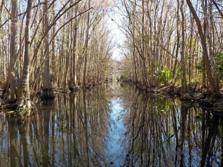
2. One of many scenic spots along the river
3. The river boat “Okeehumkee” of Hart’s Line on the Ocklawaha River
4. A docking post for the ill-fated canal
5. One of the side waterways
6. A local resident watching boaters