 By James Marsh
Linville River is considered one of the state’s better trout streams by some anglers. It is also quite different from many other North Carolina trout streams in some ways. The uppermost part of the Linville River starts close to Linville Gap in the Blue Ridge Mountains near the little community of Crossnore. Fly fishing the Linville river is best during the Spring and Fall months.
The first odd thing you may notice about the Linville River is that, instead of being the typical fast flowing, headwater stream, it flows only moderately in its upper sections. It meanders along as if it were going to stop; however, its upper waters are located at a high elevation and the water still stays well oxygenated. In that sense, it’s more like a Western alpine headwater stream than an Appalachian mountain headwater stream. It runs right along state highway #105 to Linville and then continues flowing moderately along U. S. highway #221 to Crossnore.
The Linville River is a small to medium sized stream in the Crossnore area with plenty of water. From Crossnore, it flows onto National Park property at the Blue Ridge Parkway near Linville Falls. Although the stream has plenty of wild trout, it’s stocked by the state. I guess this is primarily because of its easy access. Even when the stream gets on the park service property, it’s still stocked by the state of North Carolina. It would do well as a wild trout stream in my opinion.
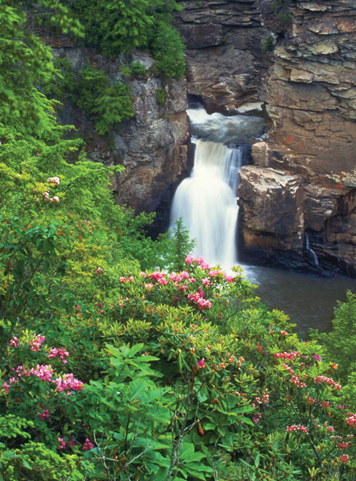
About three miles downstream from its intersection with the Blue Ridge Parkway, the stream flows into the Linville Gorge Wilderness. The falls, and 1100 acres around them, are owned by the National Park Service. There is a visitors’ center and several trails that lead to various observation points of the falls and gorge.
The Linville Gorge changes things drastically. The river declines over 1800 feet in elevation in just a few short miles. It flows over Linville Falls and becomes a fast and turbulent stream downstream from the base of the falls. At least the easy roadside access goes away. It’s about a 1400 foot change in elevation from the ridge to the stream, so getting in and out of the canyon isn’t easy. The river can be accessed by a few very steep Forest Service trails but it’s very difficult to fish the river on a day trip. Once in the gorge, or canyon would be a better word, the Linville Gorge Trail follows the stream through the entire length of the canyon.
This section of the Linville River has deep plunge pools and large brown trout. The state still stocks this section of the river, but at least they use fingerlings. I’m sure they don’t use them to make the trout grow up to be more like a streambed trout. They do it because it’s much easier. It would be interesting in knowing how many fingerlings actually make it, if that is still the current practice.
It wouldn’t be a good idea for anyone to fish this area by themselves. It would be difficult to get out in an emergency situation. As just mentioned, it is also very difficult to get into the canyon, fish any length of time, and get back out the same day. The canyon section is approximately fifteen miles long. Near the end of the Gorge the river flows into Lake James.
Reprinted by permission from James Marsh owner of The “Perfect Fly Store” an online and catalog mail order company, established to sell “Perfect Fly” fly fishing products worldwide.