(An abbreviated excerpt from “Flyfisher’s Guide to North Carolina & Georgia”)
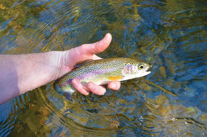
From headwater elevations of about 5,500 feet at Mount Hardy just off the Blue Ridge Parkway, the West Fork of the Pigeon River falls nearly 3,000 feet over about 18 miles to its confluence with the East Fork and the formation of the Pigeon River. Along this course, and up the river’s tributaries, there is every type of trout water, from brook trout in tight and tiny high-elevation trickles to hatchery supported and delayed harvest stretches. The water is extremely clear under normal conditions, and it is a pretty place. It is also the most heavily managed fishery in Haywood County, North Carolina.
The best public access begins upstream of Lake Logan at the boundary of Pisgah Game Lands. North Carolina 215 parallels this entire stretch, about 8 miles of water.
Just upstream of Lake Logan, the delayed harvest water runs upstream about 1.75 miles to a point just downstream of the Forest Service’s Sunburst Campground. The river here is relatively flat, with a gravel bottom, which makes for easy wading. It is also a pretty large trout stream, which allows for plenty of room to cast to the thousands of trout North Carolina stocks in the river during the delayed harvest season from October into June. One of the benefits of this out-of-the-way location is it doesn’t get hammered nearly as hard as some of the state’s more popular delayed harvest waters. And there is also good natural reproduction that goes on in the drainage as well as hatchery supported water upstream. Even outside of the delayed harvest season, anglers can find good fishing.
The next stretch of the West Fork, from Queen Creek upstream to Tom Creek, is hatchery supported. It is also about 1.75 miles of water. It receives stockings when the delayed harvest doesn’t, which accounts for decent numbers of trout along the entire lower end of accessible water pretty much year-round.
Upstream of this hatchery supported stretch the river gets tight and steep, and there are no streamside trails. Although the streambed is not as wide here, floodwaters keep the vegetation scoured back and there is room to fish. It is not, however, the kind of place you’d want to take your kids or grandfather. Getting upstream from one run to the next can be strenuous.
Upstream of the hatchery supported section, the West Fork is undesignated trout water. It is a series of steep drops and large plunge pools interspersed with some steep pocket water. This piece of water has gained a reputation for wild browns, and there are also rainbows and perhaps a few brook trout. Because it is difficult to fish, there is not much fishing pressure.
The far upper stretches of the creek’s headwaters are home to native brook trout in very tight fishing conditions.
For GPS coordinates to access points and detailed maps of all North Carolina’s and Georgia’s best trout water, check out “Flyfishers Guide to North Carolina & Georgia.” It is available at fly shops, on Amazon, and signed copies are available from the author by emailing nsc8957@gmail.com.