by Alan Richey
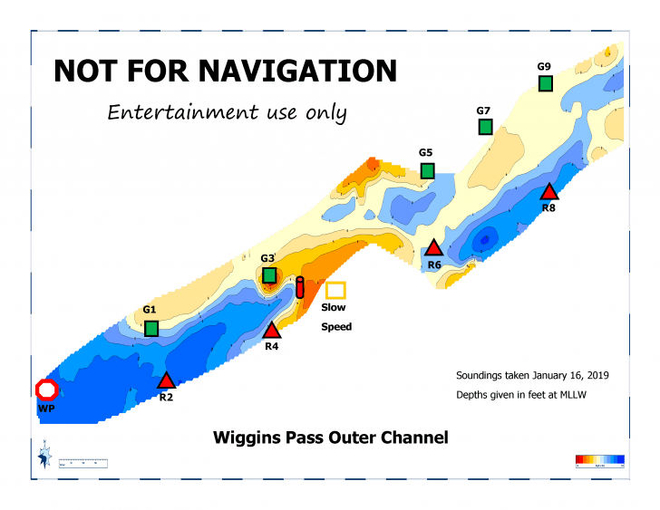
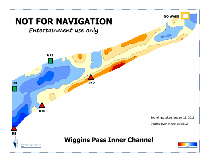
Navigating the local inlets, bays and waterways in the area from Vanderbilt Lagoon, south of Wiggins Pass, up to Ft. Myers Beach to the north requires mariners to take the time to learn what areas are navigable and which are not. These waters are continually changing and you need to personally develop ways to stay informed of these changing conditions. For example, the Estuary Conservation Association (www.estuaryconservation.org) regularly take soundings in Wiggins Pass and post that information on their website. While this historical information is not specifically for navigational purposes, it does provide you with some perspective on changes that have occurred in that waterway since the previous soundings were taken.

Information on the conditions in the channel from Estero Bay into the Imperial River is also available at the Bonita Bay Marina in the form of their publication called Channel Chatter that details information on local conditions in that area.
Recently, Flotilla 96 of the Coast Guard Auxiliary, based at the Cocohatchee Marina at Wiggins Pass, completely revamped and updated their 90-minute Local Water Knowledge course. The Flotilla will be presenting this program to the public as part of their educational outreach. This program is a terrific overview of the local inlets and inland waterways and is definitely worth attending. To find out when and where this program is available, you should contact the Flotilla at: publiced_flotilla96@centurylink.net or call 239-594-8009. This program has a series of great aerial photos of the local area from the Vanderbilt Lagoon up to Ft. Myers Beach that provides clear visual examples of the information you need to have to better understand and navigate in these local waters. This updated version of their course will provide an informative base of knowledge you can use when boating on these local waters. The Coast Guard Auxiliary is the all-volunteer, non-law enforcement division of the Coast Guard.
Safe boating!

