by Alan Ritchie
In early December, Collier County added a floating red marker just off the beach at Delnor-Wiggins State Park that marks a shallow spot on the south side of the channel protruding from the beach. Mariners should use caution in this area. As you can see from the soundings taken on November 30th, this shallow area shows between markers R4 and R6.
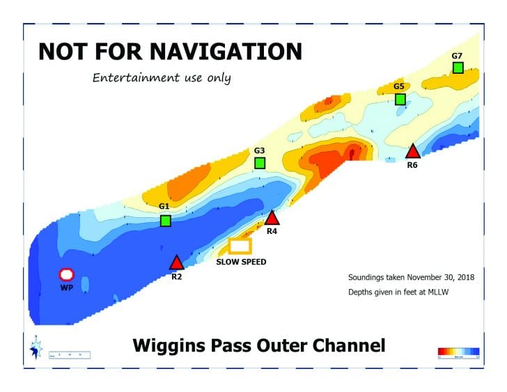
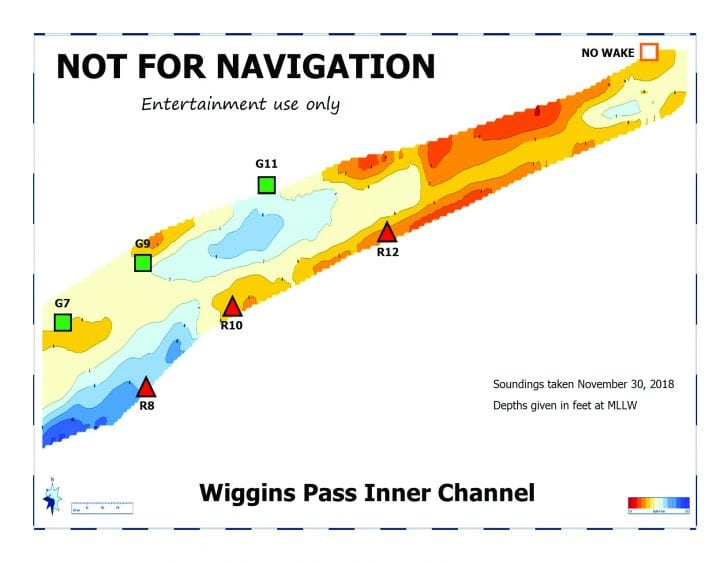
These sounding are not for navigation but do provide users of the Wiggins Pass channel with a general idea of the conditions that existed on the date of the soundings. Because the channel is subject to continuous shoaling, they may not reflect conditions at a later date. These soundings are posted on the ECA website at www.estuaryconservation.org and if you have access to a color printer, you can download the files and print your own copy to take with you when using the pass.
Navigation in the Vanderbilt Waterway going south from Wiggins Pass toward the Vanderbilt Lagoon has some areas that need to be dredged. In October, the Board of Collier County Commissioners approved funding for the engineering and permitting process for a dredge of this waterway and final action on long-term funding was approved at their December meeting. This is very good news for boaters in that area as the approved solution provides dedicated funding for ongoing regular maintenance of this waterway that should prevent these navigational issues from happening in the years ahead.
Safe boating! 12/8/18