By Alan Ritchie:
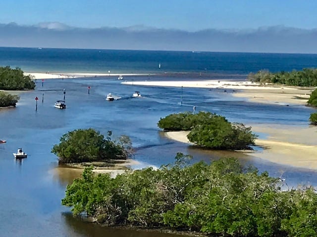
The navigation conditions in Wiggins Pass continue to be subject to shoaling but in the weeks following Hurricane Irma, conditions have been fairly stable and the channel markers pretty well reflect the best water in the Pass.
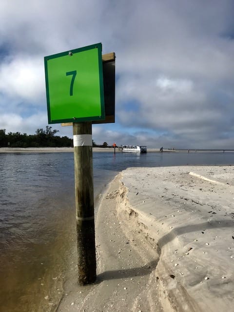
Local knowledge is key to navigating Wiggins Pass, particularly at night. As you can see from the photo of Marker Green 7, it is currently at the very north edge of the channel. In addition, you can see that it is not a straight shot in from the Wiggins Safe Water Light to the Red 12 Daybeacon.
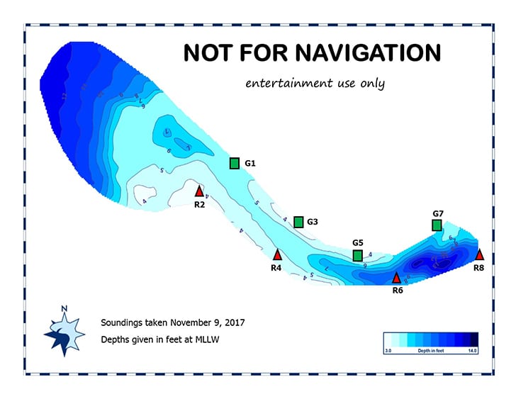
As of November 9th, the ECA soundings, while not for navigation, can provide useful historical insight into the best water as of November 9th. You can get access these soundings in the ECA website at: www.estuaryconservation.org.
Safe boating! – AJR: 11/10/17